What Are Tectonic Plates?
If you could wind the clock back by a few million years, you would find that our planet used to look rather different than it does now. You would find that countries and even whole continents had different shapes and positions. There was even a time when all the land mass in the world was together in a single super-continent.
The reason for this change is that our planets surface is dynamic. It is still moving now, albeit in amounts that are so small that we don’t notice. It is moving thanks to plates that cover the planet and these move thanks to movement deep below the surface. These plates are known as tectonic plates, and they come with some fascinating facts.
1. Different Layers
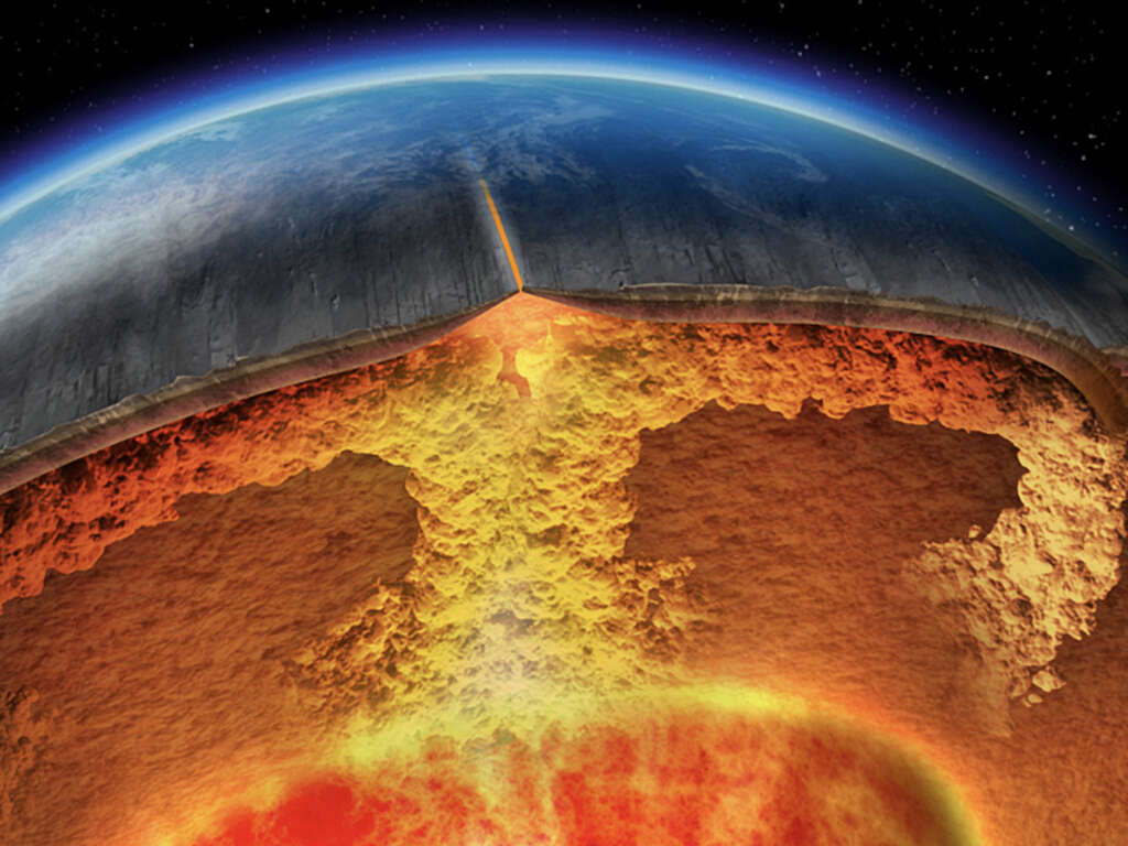
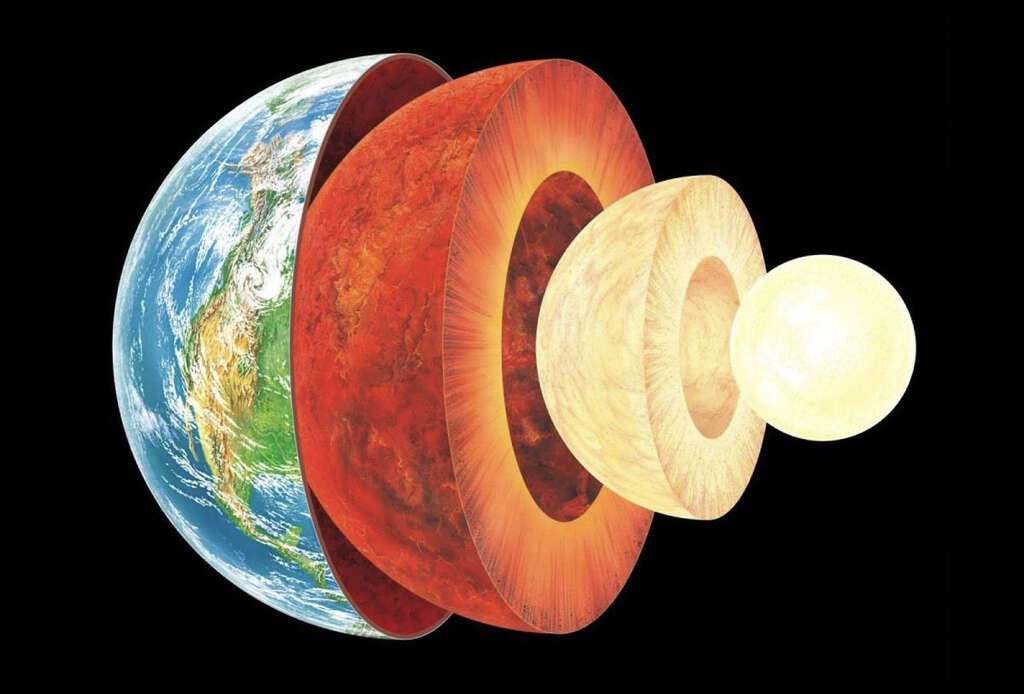
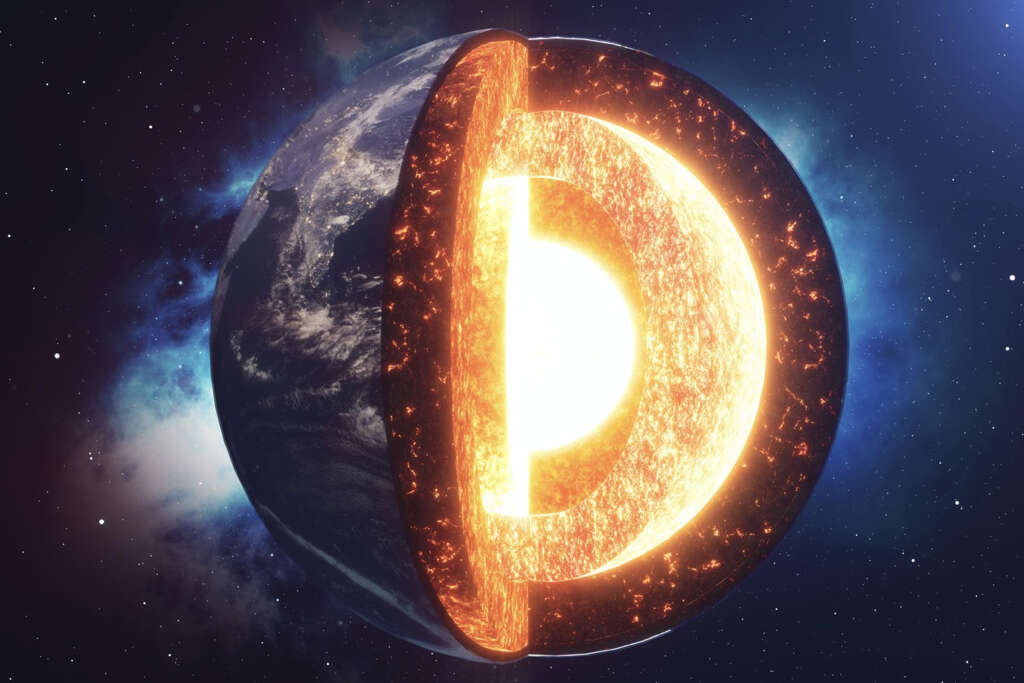
From our viewpoint on Earths surface, it seems as though Earth is a single solid rock, but that is not entirely true. It is actually made up of a number of layers and each layer has different characteristics. The outer layer, the layer that we walk and live on every day, is known as the crust. Earths crust is very thin, relatively speaking. It is as thin as 3 miles deep in some places, whereas it can be as much as 15 miles deep in others. The crust is thinner beneath the oceans (oceanic crusts) and thicker when on dry land (continental crusts).
2. Fluidity
The land that we stand on is very solid and is mostly made from very hard rock. It takes special tools to dig into it and digging deep can be a real challenge. Beneath the thin crust, however, Earth begins to behave very differently. Instead of being hard and solid, it begins to act like a liquid.
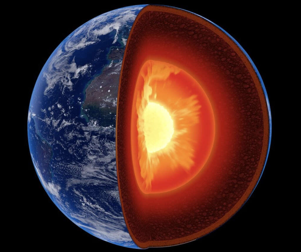
Beneath the crust is the mantle, a thick layer of silicate rock that, on a geological scale, behaves in the same way as a viscous fluid. Beneath that is the outer core, which is a layer of molten, liquid nickel and iron. The final layer, the inner core, is made of solid nickel and iron.
3. Floating Rafts
The solid crust behaves almost like a raft on the more fluid layers below. What is more is that these rafts are constantly moving, albeit very, very slowly. These rafts are known as tectonic plates and they are around 62-miles thick. The part of Earths surface that is moving in this way is known as the lithosphere.
This includes the crust and some of the upper mantle. We don’t notice this movement because of the incredibly slow rate at which it does move. Indeed, an entire plate will take around a year to move between only one to six inches. At this rate, it will take millions of years for the movement to have any significant impact.

4. Major and Minor Plates
Earth is covered by 17 plates in total and these are broken down into seven major plates and ten minor plates. The major plates are the Indo-Australian plate, the Pacific plate, the Eurasian plate, the North American plate, the Antarctic plate, the African plate, and the South American plate.
The largest of all the plates is the Pacific Plate, which covers an area of approximately 103,300,000 square kilometers. As the name suggests, this plate makes up the seabed of the Pacific Ocean. The smallest of the tectonic plates is the New Hebrides plate, which covers an area of 1,100,000 square kilometers.
5. Convergent Boundaries
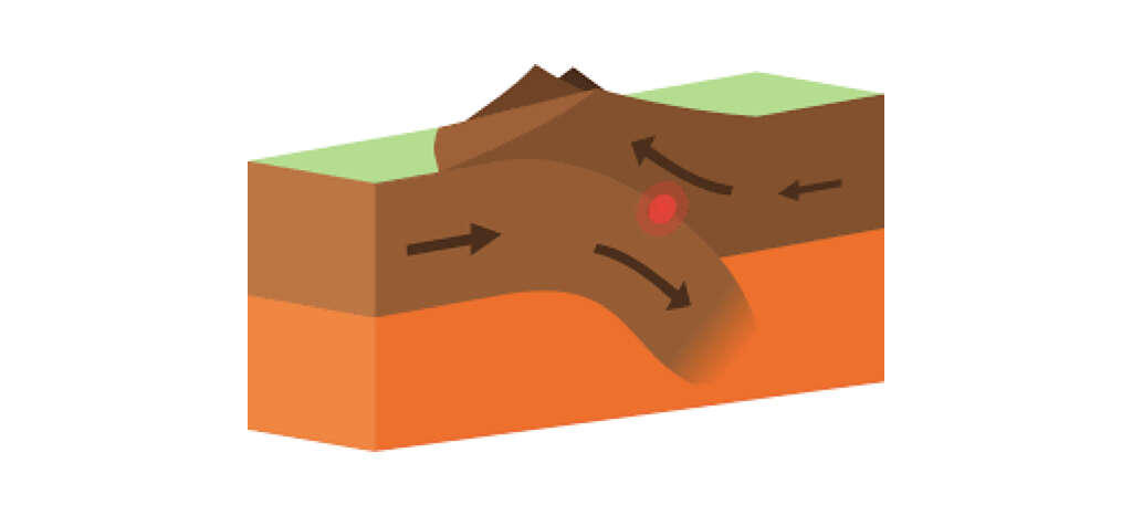
As the plates move, they interact with each other in different ways. When two tectonic plates are pushing toward each other, the area where they meet is known as a convergent boundary. As the plates push against each other, one plate is sometimes pushed beneath. This is known as subduction.
Alternatively, plates pushing against each other can cause the land to buckle and rise where the plates meet, forming mountains. The Himalayas, for example, were formed by the Eurasian plate and Indian plate pushing against each other and pushing the land upward. Convergent boundaries are often where we will find the most intensive geological activity, including earthquakes and volcanoes.
6. Divergent Boundaries
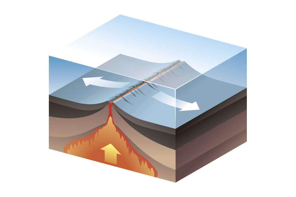
Divergent boundaries are quite the opposite of convergent boundaries in that they move away from each other rather than toward each other. As the two plates move away from each other, hot magma is pushed up from below where it cools and forms new land. Divergent boundaries that are located under continental plates will pull the land apart causing a rift, and will often allow rivers to form.
Eventually, a new sea will be formed when the rift drops below sea level. The East Africa Rift Valley is one example of this happening. The mid-Atlantic ridge is an example of divergent boundaries involving oceanic plates.
7. Transform Boundaries
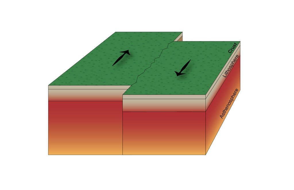
The third type of tectonic plate boundary is the transform boundary. In transform boundaries, the plates neither push toward or pull apart from each other. Instead, they scrape past each other as they move. This sliding will often cause tension to build up between the plates.
The tension will continue to build until eventually something gives way, and the plates snap much like an elastic band will snap under too much pressure. This causes a tremendous release of energy and can be responsible for some of the largest earthquakes. When this occurs beneath the ocean, devastating tsunamis can also be released.
8. The Mariana Trench
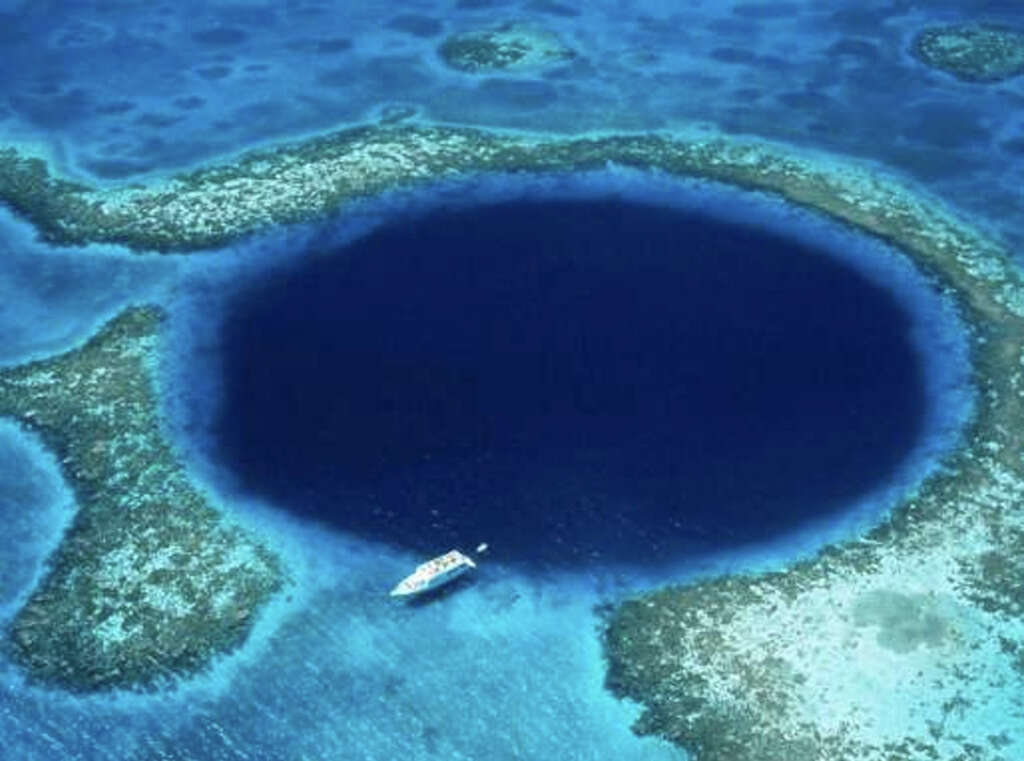
The Mariana Trench is the deepest part of Earth. At 7-miles deep, only the latest high-tech submarines can reach it because of the crushing pressure from the vast amount of water below. If we were able to lift up mount Everest and drop it into the trench, its peak would still be over a mile below the surface of the water.
The Mariana Trench is caused by a subduction system on a divergent plate boundary. The trench is more than 1,500 miles long and is, on average, around 42 miles wide. This part of the world has been explored so little that we are still discovering new species there.
9. The San Andreas Fault
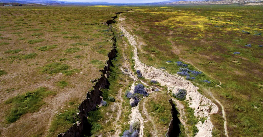
The San Andreas fault is one of the best known of boundaries. It is found on the Western coast of the United States and is an example of a transform boundary. In some areas such as on the Carrizo Plain, the fault is clearly visible as it stretches across the landscape. The San Andreas fault is responsible for some of the worst earthquakes in history.
In 1906, a quake estimated to be 7.8 on the Richter scale was unleashed in Northern California and at least 3,000 lives were lost. Experts believe that sufficient pressure has built up for another earthquake to occur, but it is very difficult to predict when this might happen.
10. The Ring of Fire
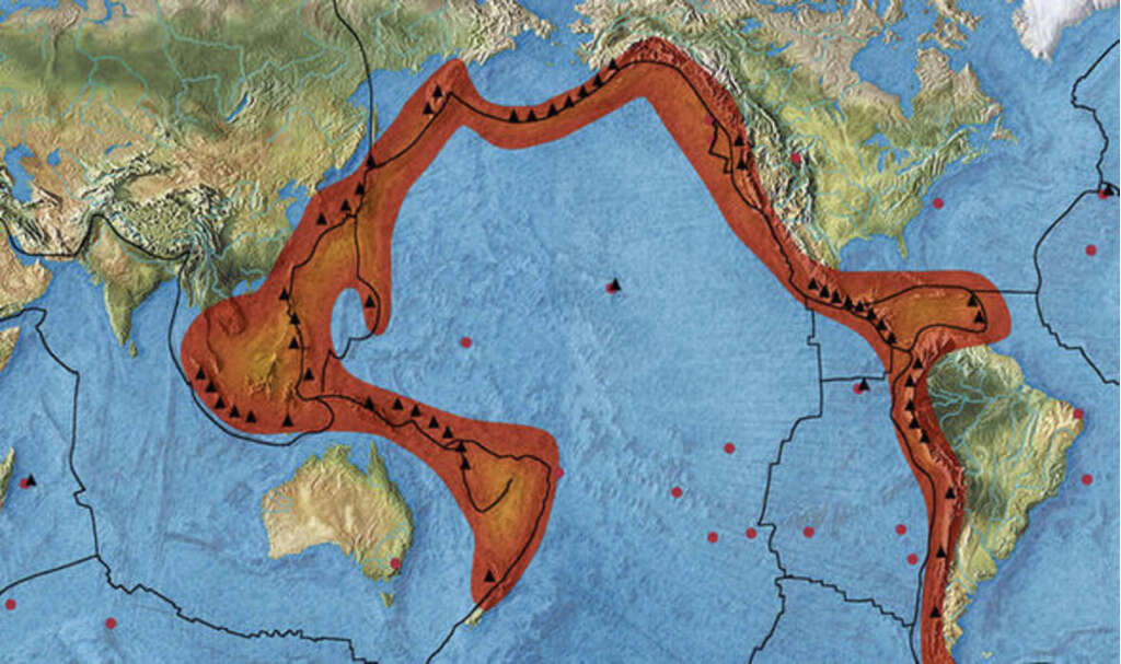
The Ring of Fire, also known as the Circum-Pacific belt, is a long line of trenches and other phenomena that are caused by tectonic plate movement. The ring is a result of boundaries between numerous plates and it forms a loose ring-shape, which is how it got its name.
The ring of fire is where the majority of the planets volcanic and seismic activity is found. The ring stretches from the western coast of the Americas to the eastern coast of Asia and Australasia. It was an earthquake in the Ring of Fire in Indonesia that caused the Indian Pacific Tsunami in 2004, causing an estimated 228,000 casualties.
